Aliens Smart Agriculture & Forestry Solutions
we move at speeds of light
END-TO-END WHOLE LIFE CYCLE MONITORING
In remote sensing-based agriculture application, Aliens provides end-to-end whole life cycle monitoring services, from classifications of crops, crop growth condition monitoring, crop yield prediction, precise fertilization, precise irrigation to natural disaster and pest monitoring.
Aliens partners with prestigious institutions such as China Agriculture University, and Remote Sensing Laboratory of Ministry of Agriculture and Rural Affairs of P.R. China.
The company has accumulated rich resources, e.g., various satellite and labelled samples dataset, models, retrieval algorithms and feld experiment sites and equipment. Aliens is accessible to the largest database for crop sample identification, high spatial and temporal feld-scale near real-time crop growth monitoring model, near real-time agricultural disaster monitor and forecast model, deep learning based high precision crop yield estimation model etc.
Agricultural Asset Management
Crop classifcation is the first step and a key foundation for agricultural asset management. With spatio-temporal surface reflectance dataset, Aliens has achieved the classification of various crops, such as wheat, rice, corn, etc. Based on machine learning and deep learning, Aliens is continuously aggregating Al capabilities in classification of crops.
Case Study
Satellite remote sensing has been used to generate crop maps of the major crops (maize, soybean, and rice) in Northeast China, the leading grain production region in China where one-fifth of the national grain is produced. Via satellite remote sensing data, researchers have produced crop maps with high overall accuracies (OA) based on ground truth data. This use case permits assessing the performance of the soybean rejuvenation plan and crop rotation practice in China, facilitating crop management decisions for regional and national food security.
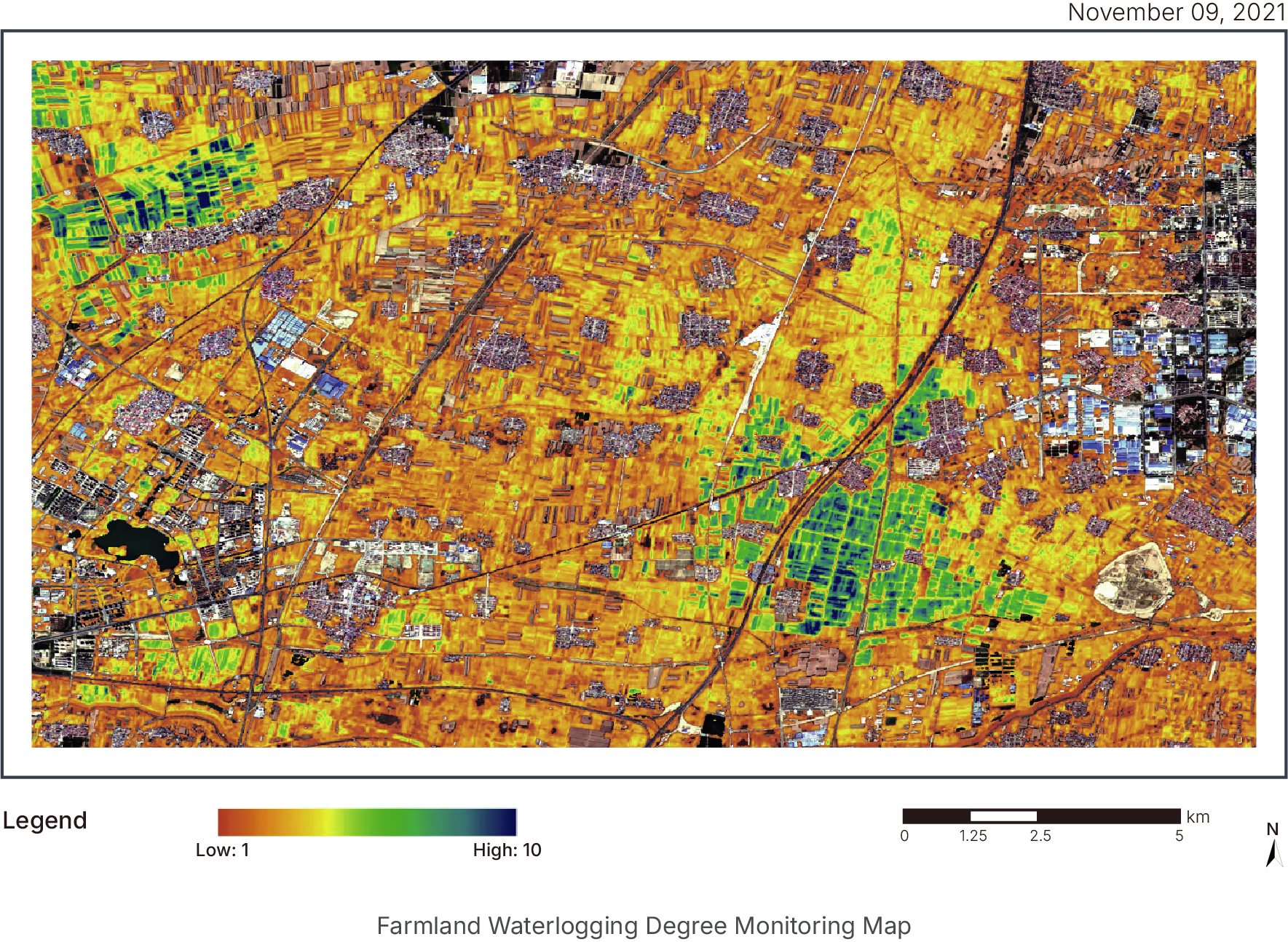
Precision Irrigation
A major challenge of modern agriculture is the limited metering of irrigation despite increasing pressure on both groundwater and surface water resources in many agricultural regions worldwide. Reliable measurement of soil moisture is critical for establishing sustainable irrigation practices. Aliens's broad-area monitoring enables effcient detection and tracking of large-scale soil moisture, delivering vital insights that can serve as the basis for precision irrigation.
Case Study
Satellite remote sensing has been used to map soil moisture levels across China. In Hebei Province, researchers have used GF-3 satellite data to successfully detect and monitor soil moisture in agricultural felds. The satellite estimations achieved high accuracy when compared with feld soil moisture measurements. The results provided insights for local government and farmers to improve irrigation precision, establishing a more sustainable irrigation model.
Precision Fertilization
Understanding soil fertility status is key to optimizing fertilizer applications throughout the season. Managing soil nutrients is often a delicate balance. Farmers and agronomists need to detect nutrient defciencies that can result in yield and quality losses, ensuring crops are getting what they need to thrive. Meanwhile, over-fertilization remains a concern, which could increase costs and make crops more susceptible to diseases, pests, lodging, and weed competition. Aliensʼs high resolution satellite solutions provide reliable detection and monitoring of soil fertility, facilitating improved nutrient management programs.
Case Study
Satellite remote sensing has been used to perform soil organic matter monitoring in China. As an important crop production and cultivation base in China, Heilongjiang Province has vast cropland for soybeans, maize, and rice, etc. The magnitude of the cropland presents challenges for cost-effective soil fertility assessment and precision fertilization. Researchers have successfully mapped the spatial distribution of soil organic matter (SOM) content of the croplands in the region based on satellite remote sensing data, proving an affordable diagnostic tool to conduct SOM analysis on a large scale and facilitate corrective nutrient applications.
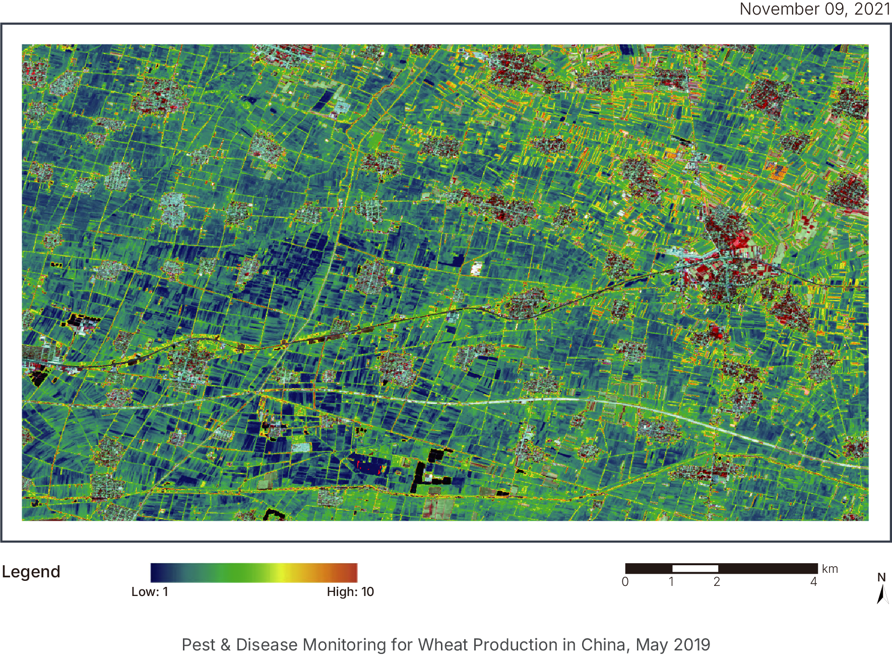
Pest & Disease Monitoring
Plant pests and diseases impact food security and cause substantial economic losses in agricultural settings worldwide. Monitoring crop health and detecting pests and diseases at early growth stages are essential to control spread, facilitating sustainable and cost-effective management practices in crop fields. Aliens provides early detection of pests and diseases with dense vegetation analysis and crop health alerts.
Case Study
Satellite remote sensing has been used to conduct nationwide monitoring of major wheat pests and diseases, such as stripe rust, sheath blight, aphids, and Fusarium head blight. By integrating satellite imagery data, meteorological data, and field measurements, researchers have achieved spatial distribution mapping, area measurements, as well as severity classification of the above mentioned wheat pests and diseases. These analyses have provided timely insights for agricultural agencies to implement measures to achieve effective control and enhance food security.
Natural Disaster Monitoring
Agriculture sector is relatively fragile in severe weather conditions. Timely forecast of natural disaster and objective assessment of financial lose are critical for land owners and insurance institutions. Natural disasters can be well monitored by high spectral, high spatial resolution sensors, e. g. Unmanned Aerial Vehicle (UAV) data, Synthetic Aperture Radar (SAR) data, and Solar Induced chlorophyll Fluorescence(SIF). Various disasters could be monitored such as flood, drought, cold, lodging,plant diseases, and insect pests.
Case Study
Our research team has used satellite remote sensing to assess flood impact on croplands in Shanxi Province. In this use case, researchers used SAR satellite imagery to extract information on the affected croplands. A combination of qualitative and quantitative analysis was conducted, regarding different levels of impact to croplands and their exact sizes. The assessment provided data-driven insights for government and insurance institutions to accurately and promptly size flood losses. The figure illustrates the impact of flood (in blue) in Shanxi Province, October 2021.
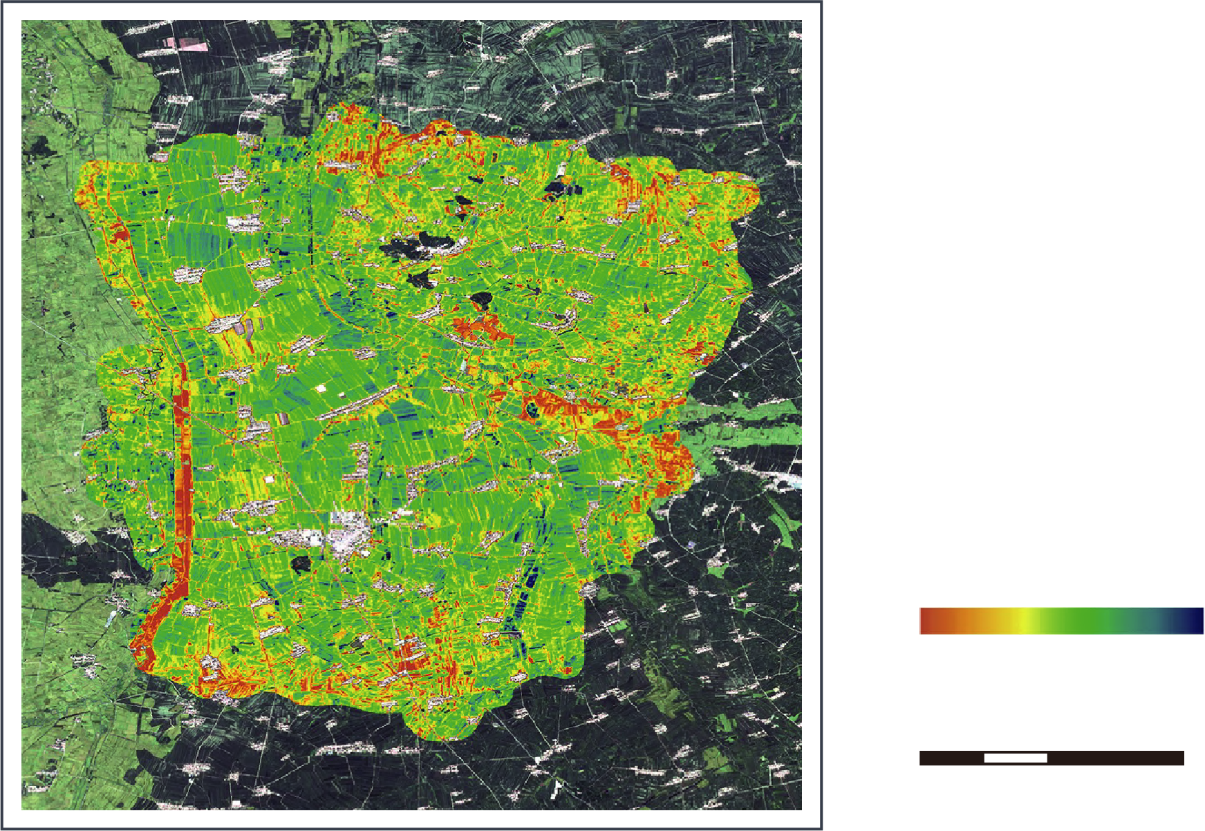
Growth Monitoring
With dynamic growth monitoring capabilities, Aliens helps government and land owners identify growth stages and respond to health issues in need of treatment. Vegetation growth condition is extracted by the retrieval of leaf area index, chlorophyll content, water content, and nutrient contents, with the radiative transfer model and remote sensing dataset.
Case Study
Our research team has conducted dynamic yearly monitoring of winter wheat from major production provinces in China. In this use case, researchers conducted crop growth analysis based on satellite imagery data collected during the growing season.The growing condition was monitored and compared for each grid with the condition from the previous year. Our analytics has supported government to make better informed crop management decisions, enabling farmers to monitor and maximize their crop health each season.

Crop Yield Prediction
Agriculture policymakers need accurate information on crop yield. The agricultural community, particularly smallholder farms, are at particular risk of losing cropland productivity. In order to support more sustainable agriculture policies, accurate, high resolution satellite data are essential. Aliens integrates high resolution satellite data, meteorological data, and field measurements to produce high-accuracy crop yield assessment. We leverage machine learning to generate data-driven yield predictions.
Case Study
Our research team has used satellite remote sensing to perform yearly assessment for major winter production provinces in China. We estimated winter wheat yield by integrating crop growth model and remote sensing images. The results from our estimates are highly consistent with the statistical data. Our analytics has facilitated locals and policymakers identify underperforming fields, implementing measures to increase productivity in needed areas.