Aliens Smart Agriculture & Forestry Solutions
we move at speeds of light
DATA ANALYSIS
Pest & Disease Detection & Monitoring
Statistics of Forest Volume
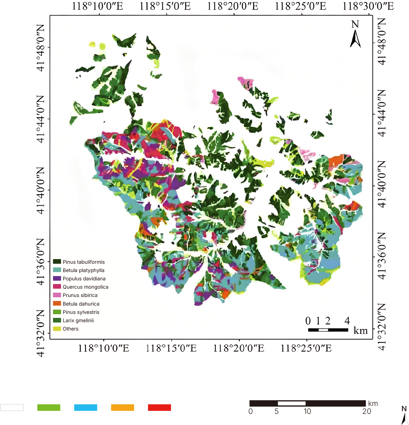
Tree Species Identification
Forest Fire Monitoring
FORESTRY PEST & DISEASE MONITORING
Full-Area Coverage
Satellites provide continuous, wide-area monitoring with no blind spots.
Multi-Source Data Integration
High temporal resolution enables weekly or monthly reports.
Early Detection
Spectral inversion helps assess plant health at different stages for early warning and intervention.
AI-Based Identification
Multispectral AI models reduce manual inspection, improving efficiency.
Efficient Workflow
Satellites detect anomalies quickly; ground teams verify selectively, reducing labor and speeding up response.
Showcase
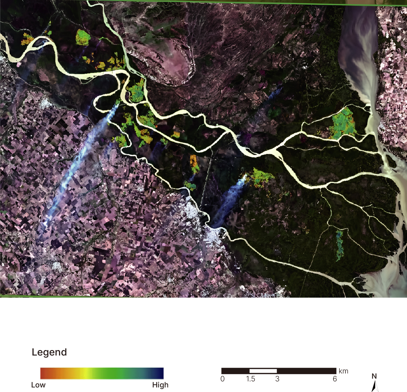
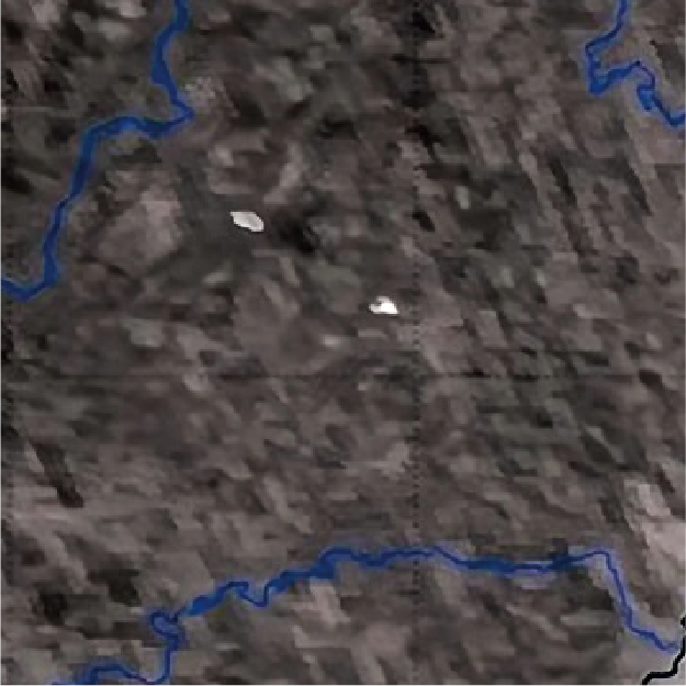
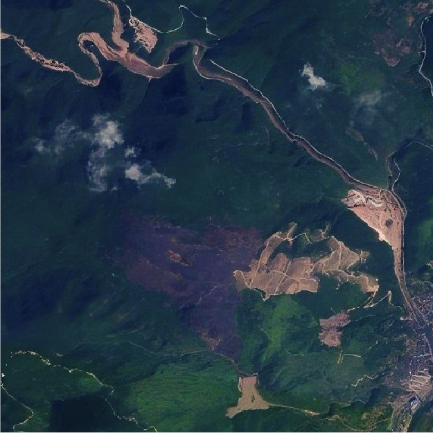
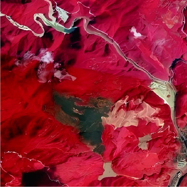
In 2022, Wenzhou, we used satellite multispectral data and AI to monitor pine wilt disease, locating individual infected trees with over 87% accuracy. Multi-temporal data tracked outbreak changes and control results.
In just 3 days, completed full-area scanning of 1,391 km² in Wenzhou, identifying 9,916 infected trees. Results successfully passed client inspection.
The Provincial Forest Protection Station reported an interpretation accuracy of 94.82% in random inspections.
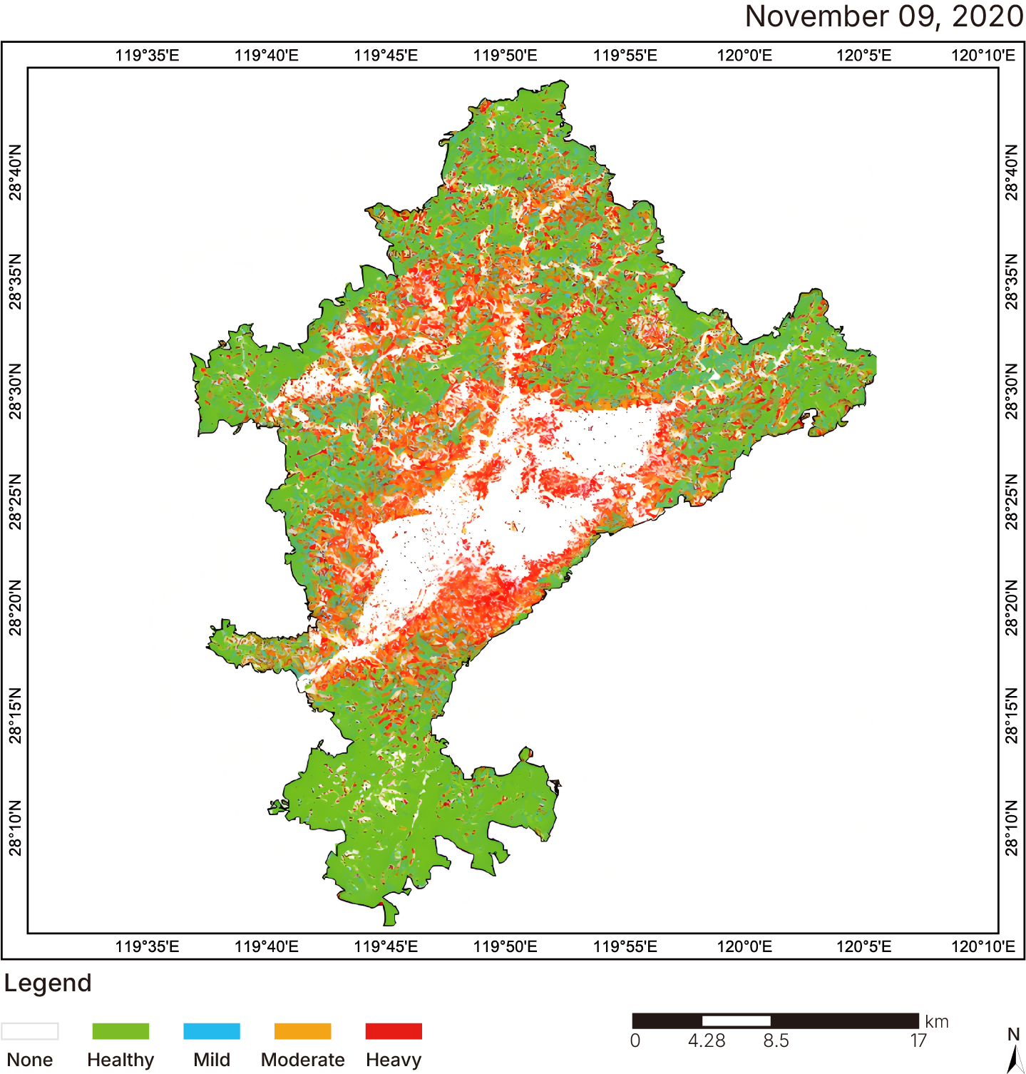
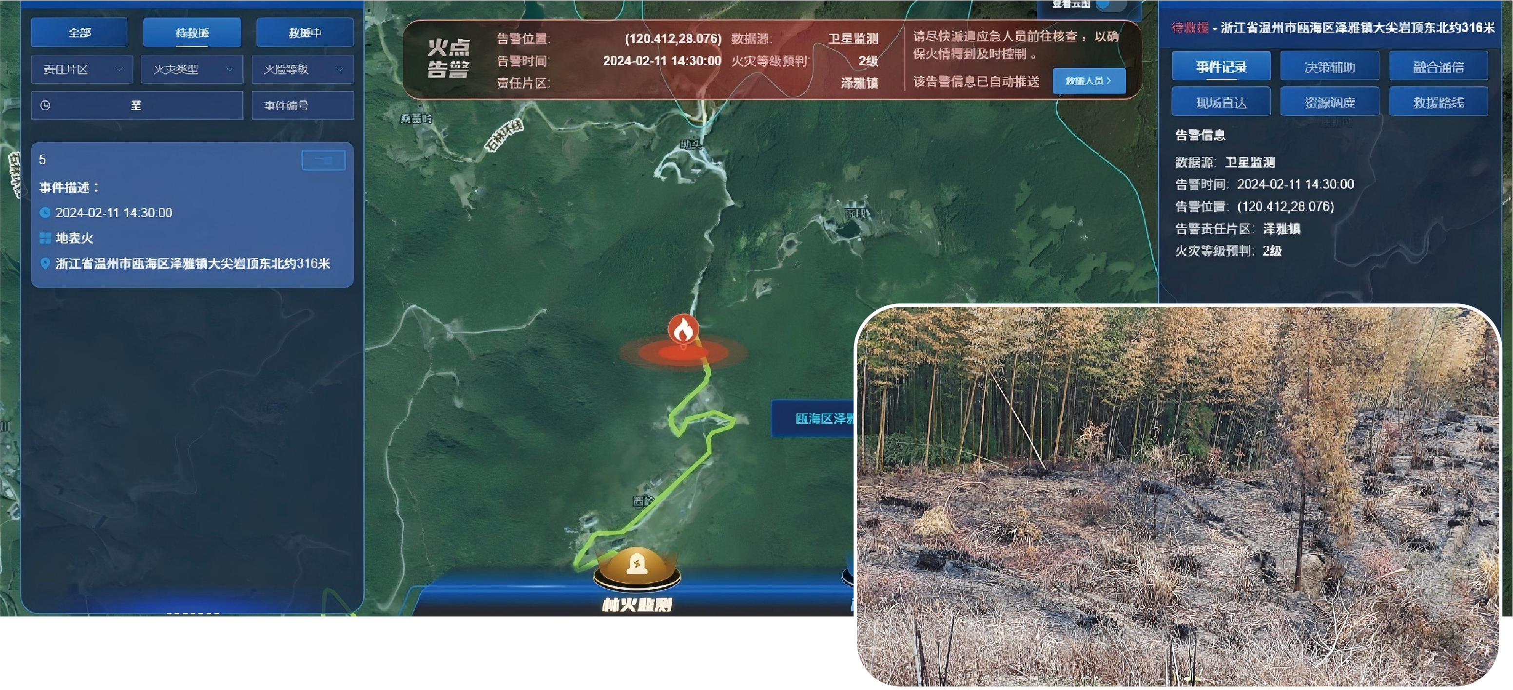
FOREST FIRE MONITORING & WARNING
Satellite monitoring offers wide coverage, frequent updates, and high accuracy. It helps detect forest fires early, track fire spread, estimate burned areas and losses, monitor vegetation recovery, forecast fire risk, and oversee forest resources. It is the main tool for forest fire early warning today.
Early Detection
Spectral inversion helps assess plant health at different stages for early warning and intervention.
AI-Based Identification
Multispectral AI models reduce manual inspection, improving efficiency.
Efficient Workflow
Satellites detect anomalies quickly; ground teams verify selectively, reducing labor and speeding up response.
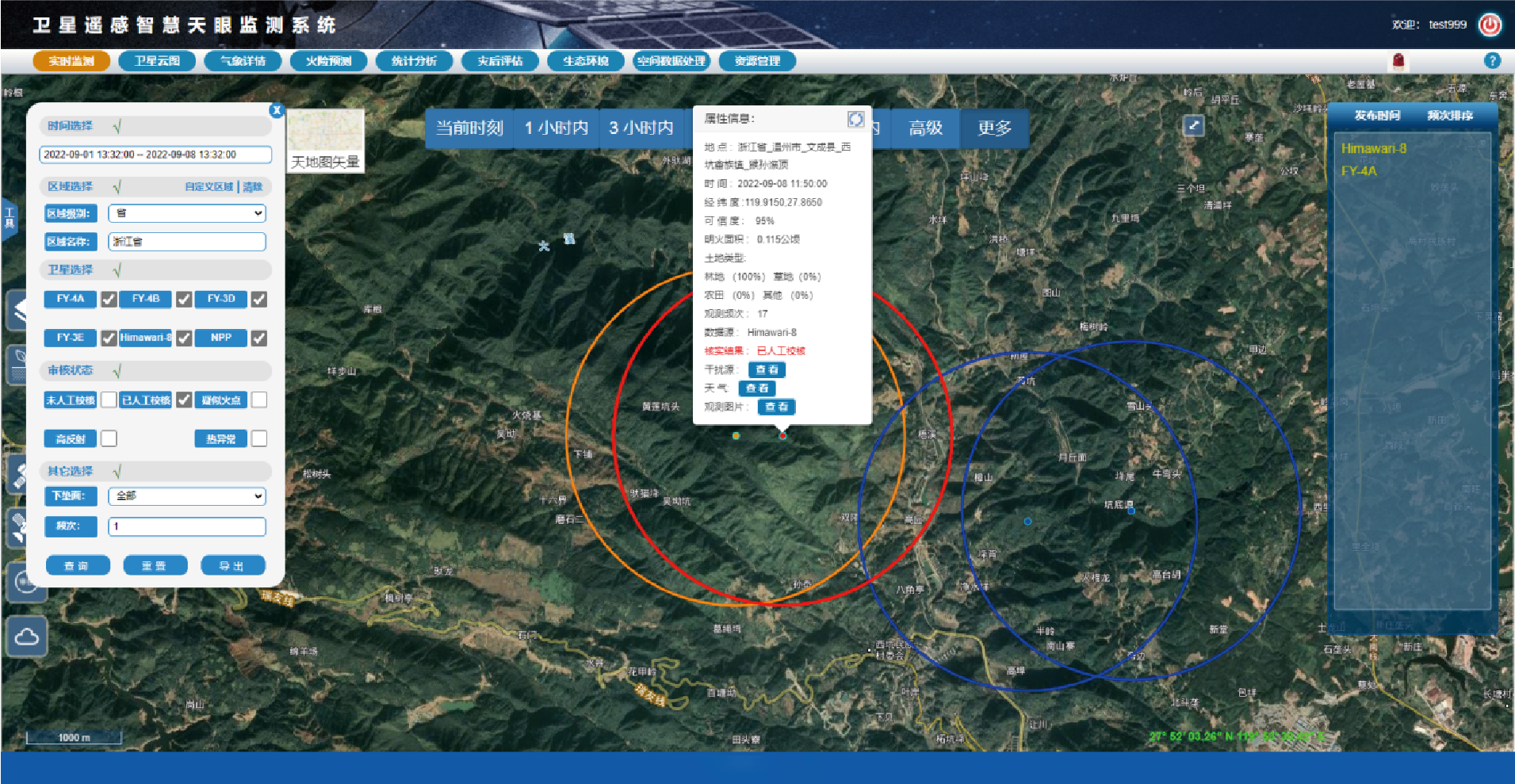
Showcase
On February 11, 2024, a fire was detected about 316 meters northeast of a town. The system sent an alert via SMS within 12 minutes and reported the result immediately. After verification, responders confirmed the fire location was accurate and quickly organized firefighting efforts, successfully controlling the spread.
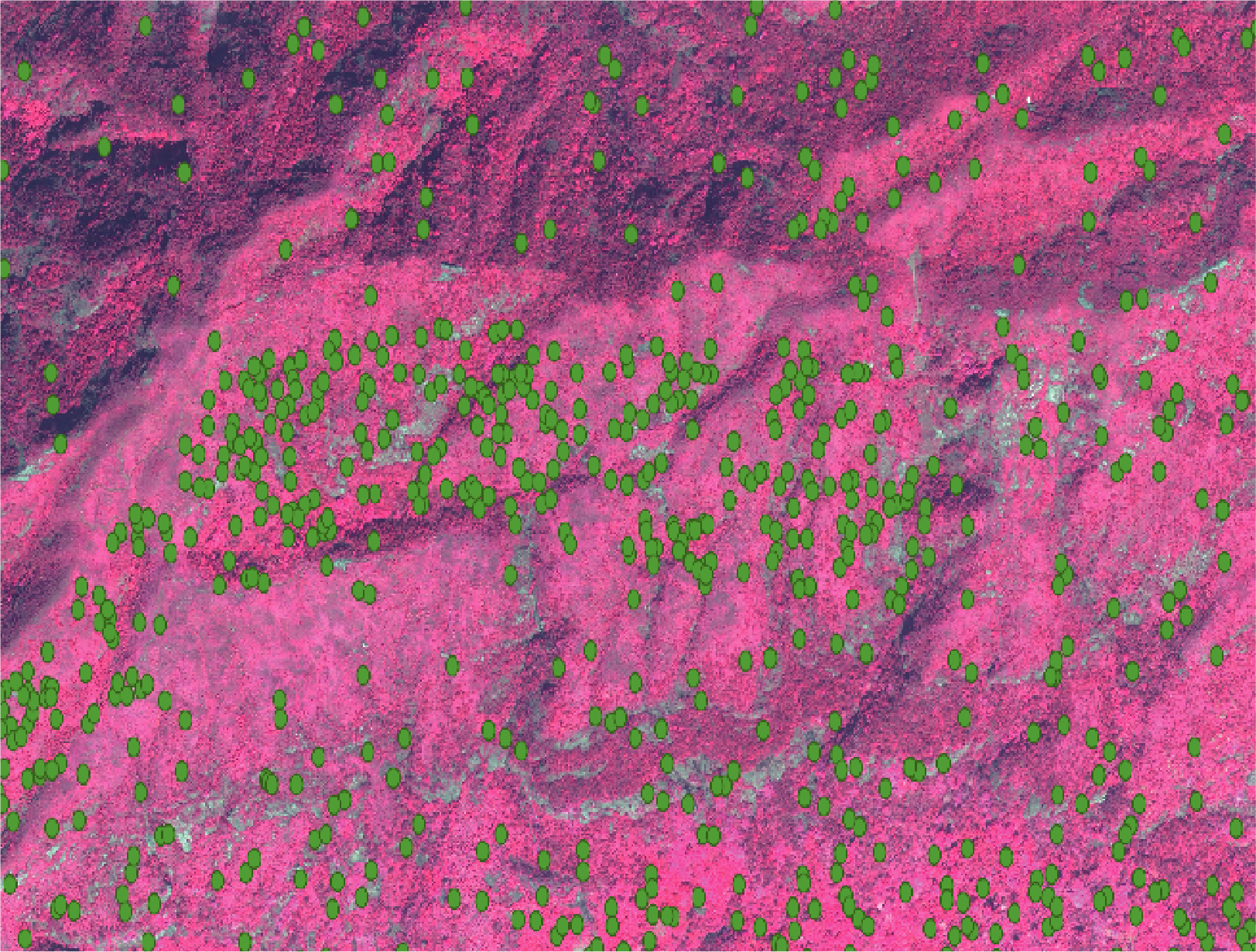
AI TREE COUNTING
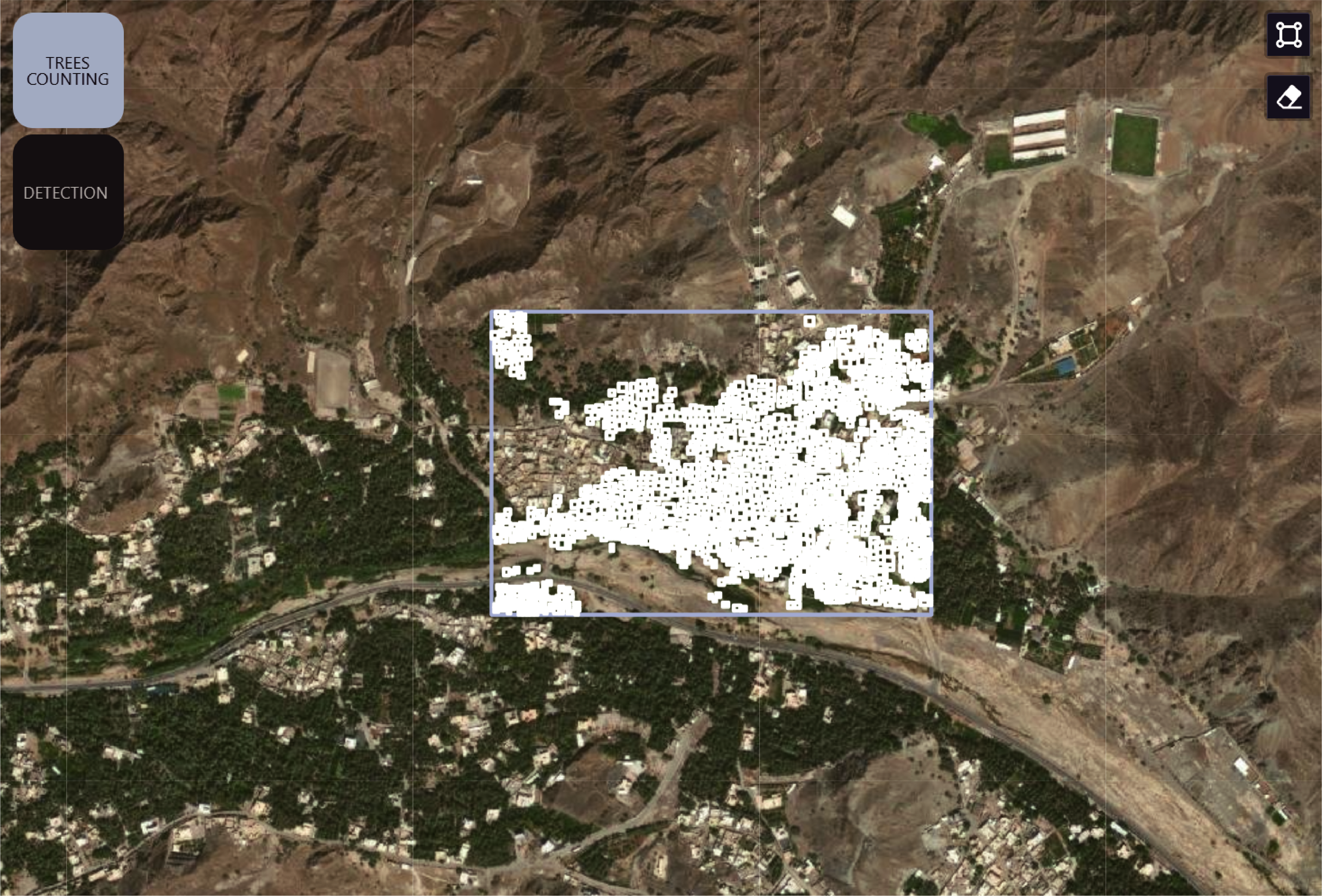
Since ancient times in commerce, nutrition, landscape enhancement, and other activities in the Mediterranean, Middle East, and North Africa regions. Currently, it is estimated that they cover more than 1.3 million hectares.
We adopted a novel remote sensing approach to recognize and monitor date palm trees and red palm weevil (RPW),using computer vision techniques. In many countries, palm trees are considered decorative trees planted in residential neighborhoods, and the RPW threat may lead to trees breaking down and hence a higher likelihood of endangering human lives. Ourwork indicates future potential and paves the way for deploying satellite imagery data to monitor RPW at large-scale as well as provide guidance for practitioners.
Imagery retrieval date: 2022/11
Count: 1707